Mitigating Risk as Shared Responsibility
Defensible spaces are confined to property boundaries — but fire isn't. We rethink defensible spaces as overlapping buffers and develop spatial responsibility networks that quantify who owes what to whom in wildfire risk mitigation.
Defensible spaces are maintained to clear flammable fuels and reduce ignition probability. By definition, defensible space is constrained to a property parcel's boundaries. But for fire, these fixed boundaries are meaningless — ignitions in neighboring properties can place nearby homeowners at risk regardless of what they do on their own land. Wildfire risk mitigation must be considered as a multi-parcel assessment. However, homeowners may not recognize the spillover effects of unmitigated hazards, or understand the complex overlapping risk regions between neighbors.
This project reframes risk as "responsibility" and develops new spatial metrics that measure each homeowner's responsibility to mitigate wildfire risk according to shared and owed regions.
Read the full paper here.
Three responsibility types are defined by the spatial geometry of overlapping defensible space buffers:
Metrics are calculated as the product of spatial overlap [ft²] and the fire spread risk (Rate of Spread, ft/min) within that region, derived from FLAMMAP fire behavior simulations. SR and OR are measured in ft³/min — analogous to water accumulating in a rain gauge over time.
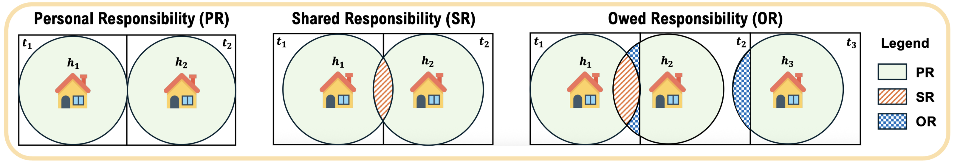
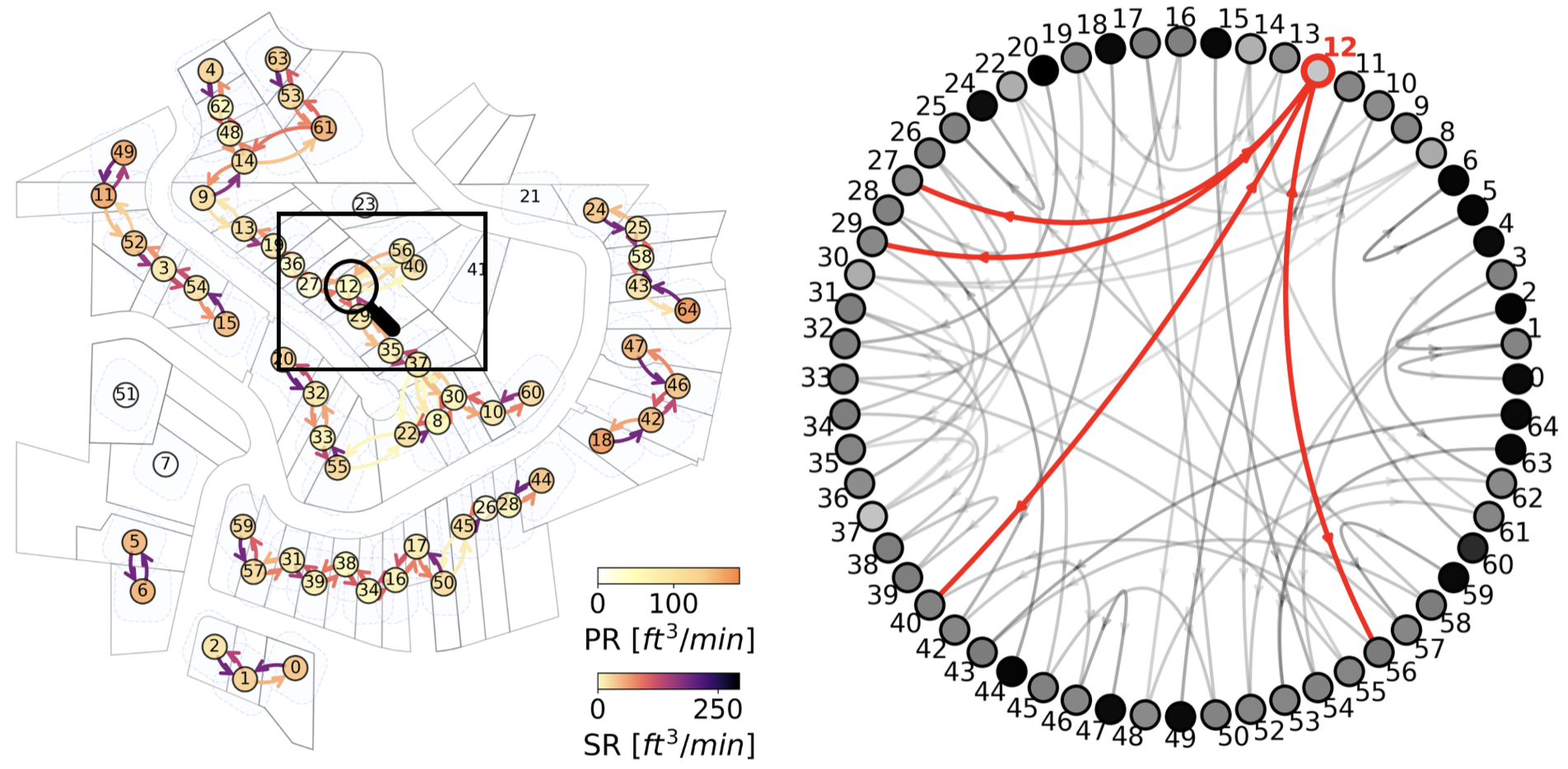
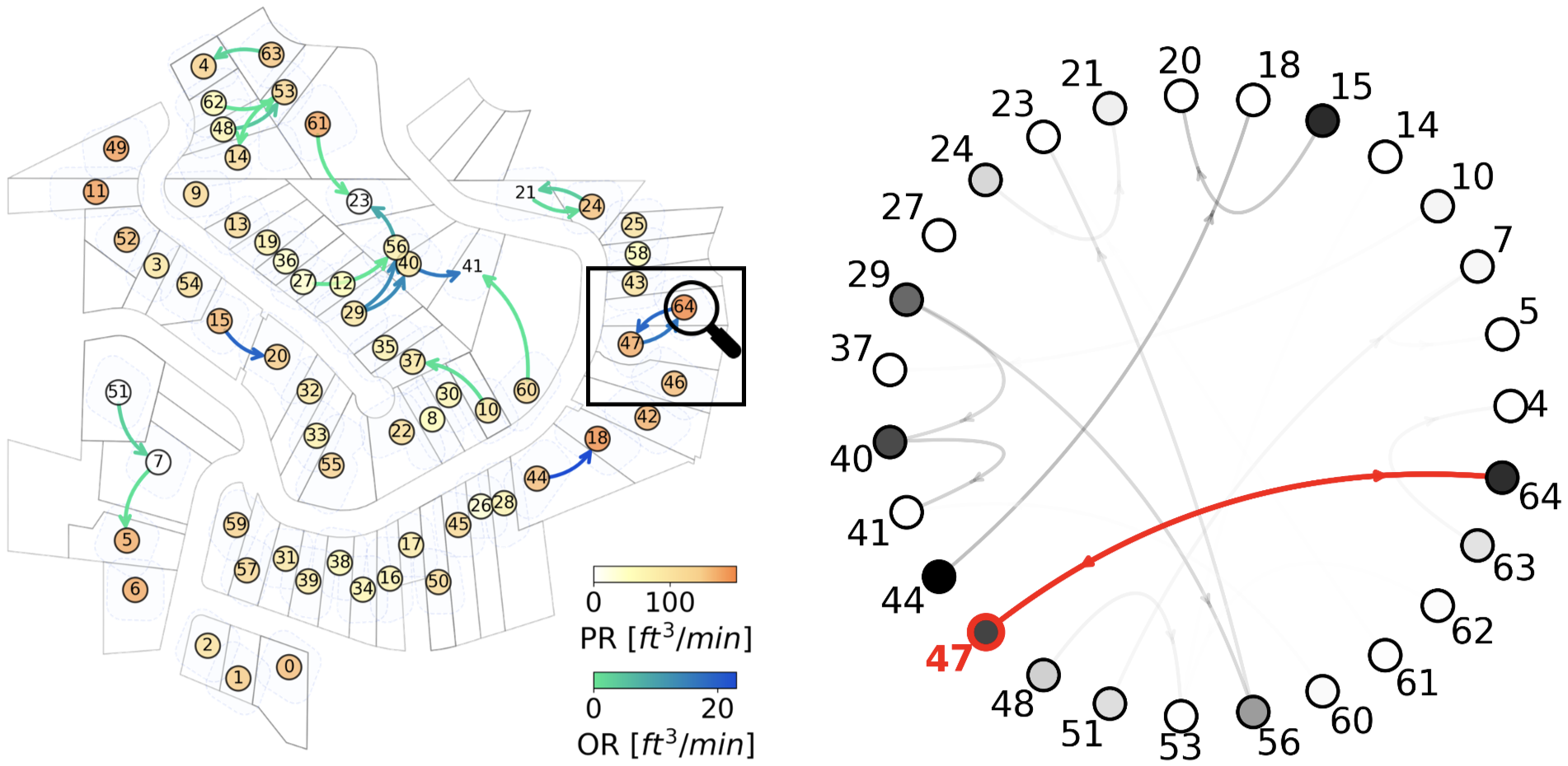
Rather than computing simple raster products per property, we build spatial directed networks of responsibility. Nodes represent each property (sized by PR). Directed edges represent SR or OR between adjacent neighbors, which is the direction denoting who owes mitigation to whom. This network representation is powerful because it captures the interconnectivity between neighbors. Hence, we can identify who needs to collaborate with whom, and where the high responsibility values (thus, high risk) exists across the community.
The SR network exhibits multiple sub-networks, identifying groups of neighbors who need to mitigate together. This is significant for shared governance and planning at the community to local govenrment level.
The OR network exhibits hotspots, identifying neighbors with higher responsibility. This may be due to neglected fuels, overlooked spaces due to property parcels and building layouts, and other potential complex factors.
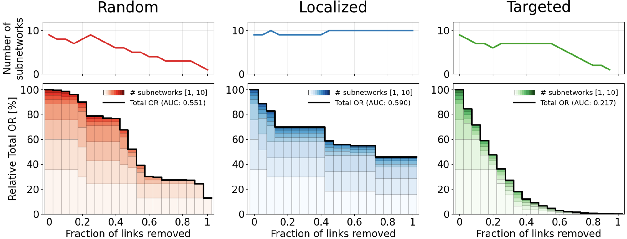
To simulate neighborhood-scale mitigation, network edges are iteratively removed and the total SR (or OR) and number of disconnected sub-networks are monitored. Three strategies are compared: Random — edges selected randomly (simulates ad-hoc awareness). Localized — first edge random, then adjacent edges (simulates word-of-mouth). Targeted — edges selected by descending SR or OR value (simulates data-driven allocation).
Targeted mitigation reduces community-wide SR most rapidly, followed by random and localized.
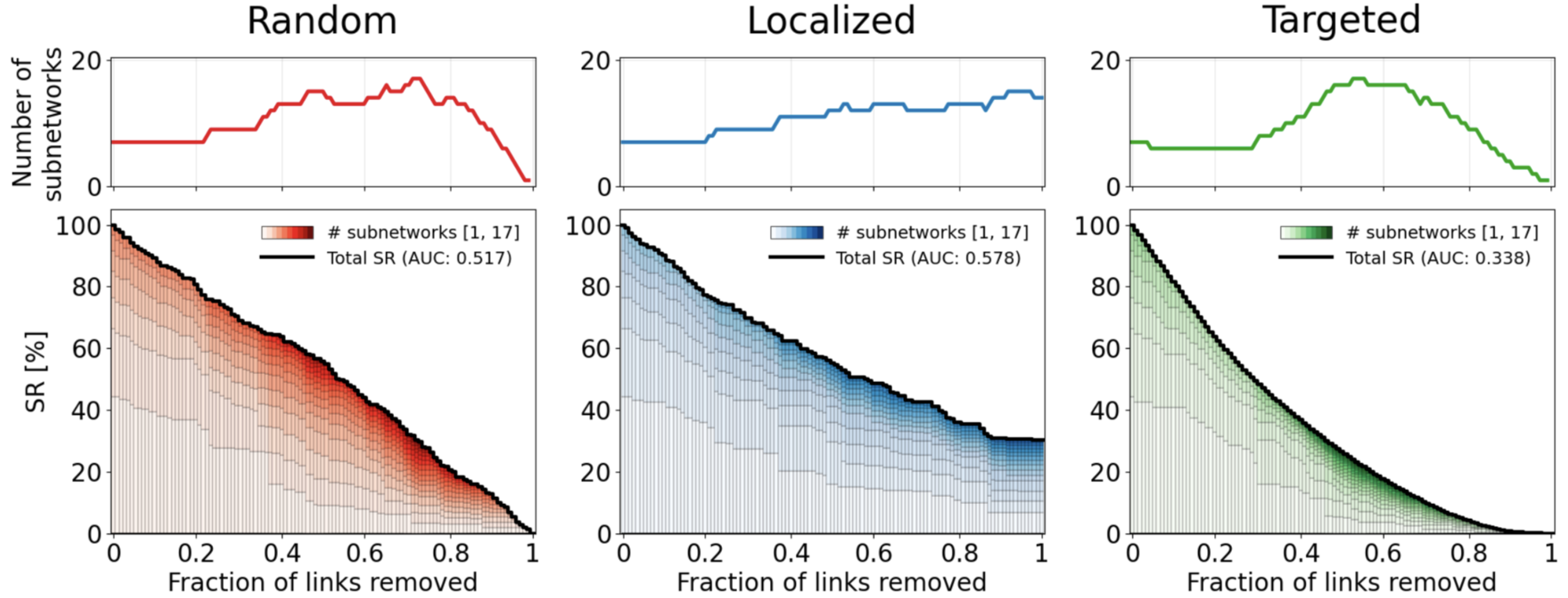
Similarly, targeted mitigation reduces community-wide OR most rapidly, followed by random and localized. Targeted mitigation performs best but is seldom implemented in practice.
Spatial responsibility networks identify who, with whom, and where wildfire risk is shared and owed at the neighborhood scale, enabling targeted strategies for community planning and collaboration.
References:
Kim, Raine, Radke & Gonzalez (2025). A Network Approach to Mapping Responsibility in Wildfire Risk Mitigation. Under review in Landscape and Urban Planning.
Maranghides et al. (2022). WUI Structure/parcel/community fire hazard mitigation methodology. NIST, US Department of Commerce.